Freedmen’s Cemetery was open for burials between 1867 and 1876. Today, there is a plaque to note where the cemetery once stood.
The adjacent Chalmette National Cemetery—then called Monument Cemetery—was established in 1864 to bury Union soldiers. They also used the space to bury those who died in the refugee camps and hospitals within Union lines. Two years in, they realized space was running out as civilian burials outpaced the soldier interments. They also planned to move soldiers buried at nearby forts and battlegrounds to this space.
The Freedmen’s Bureau—also known as the Bureau of Refugees, Freedmen, and Abandoned Lands—was a government agency established in 1865 to help Black Americans transition to living in “free” society. The agency faced many obstacles, notably the Black Codes, but they did what they could. In 1867, they began moving 4,000 bodies from the Monument side to the Freedmen’s area.
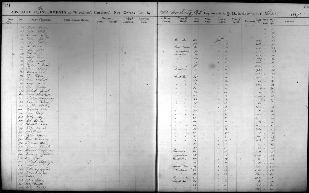
New burials were mainly from the agency-run hospital. The cemetery was well maintained and each plot was marked with a simple, wooden headboard. There were approximately 716 burials from 1867 to 1869 and most of the names and causes of death were recorded. The original records exist at the National Archive. I have transcribed the names of the new burials and added them to find-a-grave.
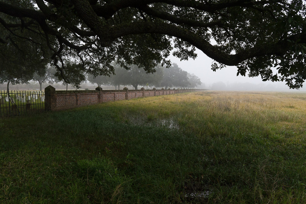
In 1869, Freedmen’s Hospital was shuttered and by 1872 the entire agency was disabled. In 1873, a memo from the Quartermaster’s Office mentioned the cemetery was abandoned. The national cemetery had no desire to acquire or maintain the property and to further separate the two areas, they erected a brick wall. The land, then owned by the city of New Orleans, was sold in 1875 for the Agricultural & Mechanical College. The college’s Chairman of the Board made attempts to have the national cemetery take over maintenance duties when he found evidence of U.S. Colored Troops buried there. No movement was made by the federal government.
The cemetery now lies within the Chalmette Battlefield—part of the Jean Lafitte National Historical Park and Preserve. Ground penetrating radar studies have been conducted to find the edges of the burials, but the results are inconclusive due to the depth of the bodies. The river levee was only knee-high until recently, so the river would flood making more soil on top of the burials.
Note: I added and wrote the Wikipedia page, so any similarity isn’t plagiarism.